AA County Seeks Input on Walk & Roll
By Keri Luise
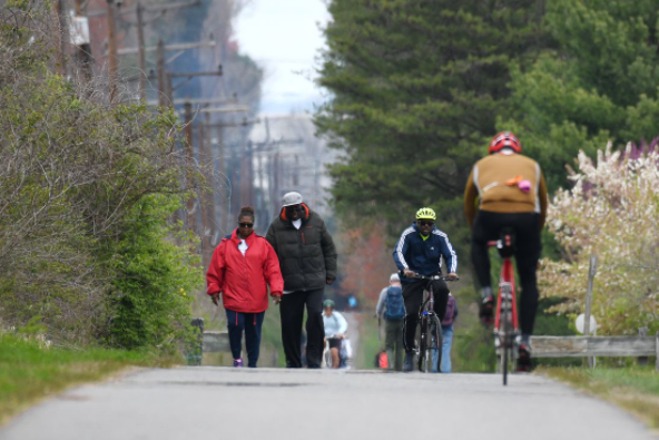
Getting from where we live to where we want to go is not always the easiest task when driving isn’t an option, especially when active transportation options are limited or unsafe. Anne Arundel County is looking to solve problems like this with a pedestrian and bicycle master plan called Walk & Roll Anne Arundel.
The Anne Arundel Office of Transportation is developing a vision for a more connected community through accessible paths for walking, bicycling and rolling—using a wheelchair, roller skates, a scooter, or any other active transportation device.
According to Office of Transportation Director, Samuel Snead, “Implementation of the plan will result in a connected network of streets and trails where it’s safer, easier, and more comfortable to get around outside of a vehicle.”
Right now, community members have a chance to provide their input on where critical improvements are necessary to create a safe and comfortable bicycle and pedestrian network. Walk & Roll Anne Arundel includes an interactive online map where the public can take a short survey and drop a pin or draw a line and make comments directly into the map, as well as see what others are saying.
The survey asks participants about their habits of getting around the county including reasons for walking and biking, how they feel about traveling by bicycle, and what would encourage them to walk or bike more. The interactive map then allows the participant to simply draw on the county map and make comments on what is missing or what can be improved in that specific spot, such as crosswalks, ADA accessibility, bicycle lanes, etc.
For example, one participant, Luis Lucchini, dropped a pin at a shopping and restaurant area along the Baltimore Annapolis Blvd in Glen Burnie with a barrier to walking or biking. “Protect this crossing better, people from the neighborhoods on the east will be better connected to the town center,” Lucchini says in his comment.
Another resident dropped a pin at the intersection of Locust Avenue and Cedar Park Road in Annapolis where they comment that they have also experienced a barrier to walking or biking. “People headed north on Locust come T-bone at Cedar Park Road. This is a somewhat blind intersection,” the resident comments. “A curb cut for stroller and bike traffic on the north side of Cedar Park Road would help with the ‘dart across method’ that most people utilize here to get to the [Naval Academy] stadium. Sidewalks on the south side of Cedar Park Road would also fix the problem. Adding a sidewalk would make the road narrower and calm the traffic. Double win.”
According to Snead, the initiative has a strong emphasis on equity. “We recognize that there are many residents that rely on bicycles as their means of transportation,” Snead says. “We look forward to the public’s input as we formulate the plan.”
This initial opportunity to provide input on Walk & Roll Anne Arundel! will be available to the public through March 1.
“After this initial round of public input through the interactive map, there will be nine other public meetings throughout the county,” Snead says. “The plan is scheduled for completion for Fall 2022.”
The initiative is the first step to creating alternative options from vehicular travel. “We hope to provide more and better facilities to allow all Anne Arundel County citizens the opportunity to hop on a bicycle or go for a brisk walk for a trip to the store, work, transit, or recreation,” Snead says.
It will include improvements to existing planned trails as well as developing new trails to traverse the county. This will include the B & A Trail, the BWI Trail, the South Shore Trail, the Broadneck Trail, as well as surrounding points of interest such as Kinder Farm Park, Downs Park, and Anne Arundel Community College.
According to Snead, there is a high potential for walkability in the county’s town centers and the goal is to make them more bicycle and pedestrian friendly, both within the town center, but also to get to the town center. “The town centers will get specifically identified in the plan because they comprise some of the planned density in the county, as well as containing transit options, such as the Odenton Marc Station,” Snead says.
The Walk & Roll Anne Arundel! Plan will also identify a network for areas like BWI, Arundel Mills, Annapolis Mall, Anne Arundel Medical Center, Baltimore Washington Medical Center, schools, major employment centers, recreation centers, and more.
“Since the last update in 2013, there have been several industry wide changes to the way planning for active transportation occurs,” Snead says. “This plan will embrace new innovations and identify a connected network and a means of project prioritization to building out the network in the short, mid-, and long-term.”
https://aacounty.civilspace.io/en/projects/walk-roll-anne-arundel