|
Burton on The Bay
By Bill Burton |
 Our Disappearing Islands
Even the biggest measure their future in decades.
The island was bounded on the north by soft crabs, on the east by fresh fish, on the south by mosquitoes, and on the west by all three.
— Capt. E. Ashton Plummer’s recollection of Sharps Island
Sharps Island is gone. All visible evidence of it has vanished from the Chesapeake Bay. All you’ll see to mark the spot is a warning buoy cautioning sailors of the hidden shoals that once comprised an isle of more than 475 acres. Today, it is best known as a favored fishing ground of sports and commercial fleets, marked by its big, tilted, namesake red lighthouse a few miles south of Tilghman Island.
It is but one of hundreds of islands that have already disappeared or are in the process of disappearing in our Bay. Some were once thousands of acres; others only a few. As storms, winds, tides and currents relentlessly take their toll, much of the lore of the Chesapeake now remains (or will remain) only in memories, and memories, like islands, fade over time. What is — or will be —left?
Bill Cronin’s New Book
Thanks to people like William B. Cronin of Silver Spring, more than a little will be around to document and connect the Bay and the islands of yore to the Bay of the onimous future.
The time will come when all the islands are gone.
“They will all slide into the sea,” said Cronin, a retired Johns Hopkins Chesapeake Bay Institute oceanographer, when we chatted over the phone the other day. All of them will go. For starters he named a few: Holland, Smith and Tangier in the lower reaches of Maryland’s share of the Chesapeake.
Holland, at the southern tip of Dorchester County, is now abandoned, but once had on nearly 200 acres its own post office, church, schoolhouse and doctor — plus a championship baseball team. Three years ago, it was 21 acres, losing an acre a year.
Cronin dates the end for Tangier and Smith islands only two decades hence. How can that be, I thought — until he reminded me that during Isabel a couple of years ago, everything was under water. Smith Island has lost only 277 of its 9,776 acres over the past 150 years, but what remains is barely above the brine and is mostly marshland. Only half of Tangier Island of 150 years ago remains, about 700 acres in all, and all but 83 already marshland.
At the turn of the 21st century, Smith Island had 375 residents and Tangier 700 — and both are seemingly busy tourist attractions and hubs of Chesapeake harvests. Gone? And in only 20 years? I had to call Cronin back, just to be sure I read my notes correctly.
I did. In two decades, he figures the exodus of the remaining citizenry will be underway. “It’s only my guess, but I have been studying islands and the Bay for a long time,” he said.
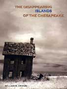
William B. Cronin’s 232-page book, The Disappearing Islands of the Chesapeake was released this month by The Johns Hopkins University Press. Research was painstaking and thorough, and the finished product comes off as a very interesting and revealing documentary of life on the Bay and the ever-changing life of the Bay itself.
I guarantee you will not lose interest as he isle-hops from Garrett Island on the Susquehanna to historic Jamestown in Virginia, touching more than 40 in all — and all disappearing.
The Bodine Bonus
If that isn’t enough, here’s the kicker. Many of the photographs of life on the islands were snapped by A. Aubrey Bodine, The Sun’s legendary photographer whose works — especially those of the Chesapeake and its people — are treasured everywhere. Perhaps snapped isn’t the appropriate word; I don’t think Aubrey ever snapped a picture in his life.
In nearly 60 years of newspapering, I’ve worked assignments with countless photographers, and never was there one as deliberate and painstaking as Bodine. More than a few times, I stood by for hours as he waited for the right light, pose and composition before he snapped the lens of his favorite camera, an ancient Linhof.
If ever one captured the face of the Bay, it was A. Aubrey Bodine, and many of those faces and places of the Bay he captured before his death in 1970 are faces and places no longer around other than in his photography. In much of his Bay work, it’s as if he knew he was photographing history.
Counting the Days
Cronin adds photographs he took dating back to the 1950s, and he completes the imagery of the loss of islands, villages and marshlands with words, many drawn from his own experiences, and others from colonial and state records and newspaper accounts.
Picture Sharps Island losing the race to erosion, down to 94 acres in 1900, its steamboat pier gone, and within 10 years its hotel closed and dismantled — the lumber carried off to build homes on Tilghman Island. In 1963, the last of the land was underwater. Fourteen years later, ice tilted the lighthouse 15 degrees, and she still leans to this day as she beckons anglers to toss over their lines for rockfish, blues, sea trout and black drum on what is now known as Sharps Island Flats.
In the Susquehanna there remains Garrett Island, high and rocky, a formidable holdout against nature, but gone are the fish sheds that processed the shad and herring. She will be among the last, as will Kent Island of 19,628 acres, the largest in Chesapeake Bay with an average terra firma loss of only 12 acres a year. Cronin said even her time will come.
Also shored up quite well is Tilghman Island, which over the past 150 years has lost 672 acres of her 1,905. At a loss rate of 4.4 acres a year, Tilghman should be around for some time to come. Just below Tilghman is uninhabited James Island, where rising water and damaging waves eat away land at a rate of eight acres a year, leaving only 85 acres of a Bay community that supported 20 families and their Methodist Church. It was here the first sika deer were imported to Maryland, and Cronin writes even the deer are losing their habitat.
Bloodsworth, Barren, Poplar, Wye, Cobb, Eastern Neck and Watts are just a sampling among others covered by the author, who incidentally is the brother of the late Dr. Eugene Cronin, who with the late Dr. Reginald Pruitt are considered the modern-times Fathers of scientific research on the Chesapeake. You can learn much from this book.
The Disappearing Islands of the Chesapeake — in large format with 150 half-tone illustrations, charts old and modern of the islands — is priced at $35